
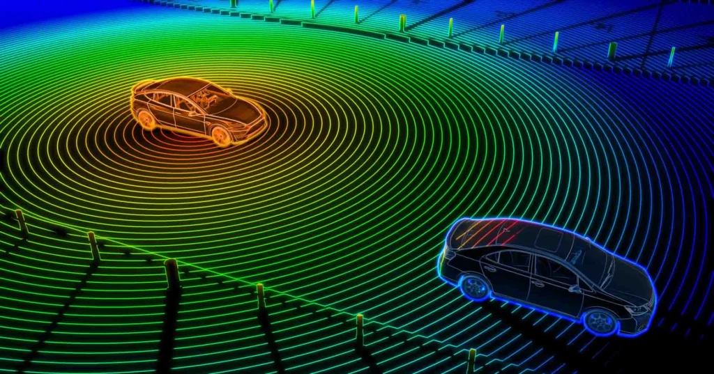
We humans generally face difficulties while driving in a dense fog environment, but have you ever thought of how self-driving cars, like Tesla, have overcome this or many other obstacles? This has become possible because of an innovative technology – Light Detection and Ranging (LiDAR).
It uses laser pulses to map environments accurately, revolutionizing industries from autonomous vehicles to AR/VR, space exploration, and drones as well. But how exactly does LiDAR work, and why is it becoming a game-changer in spatial computing?
Definition
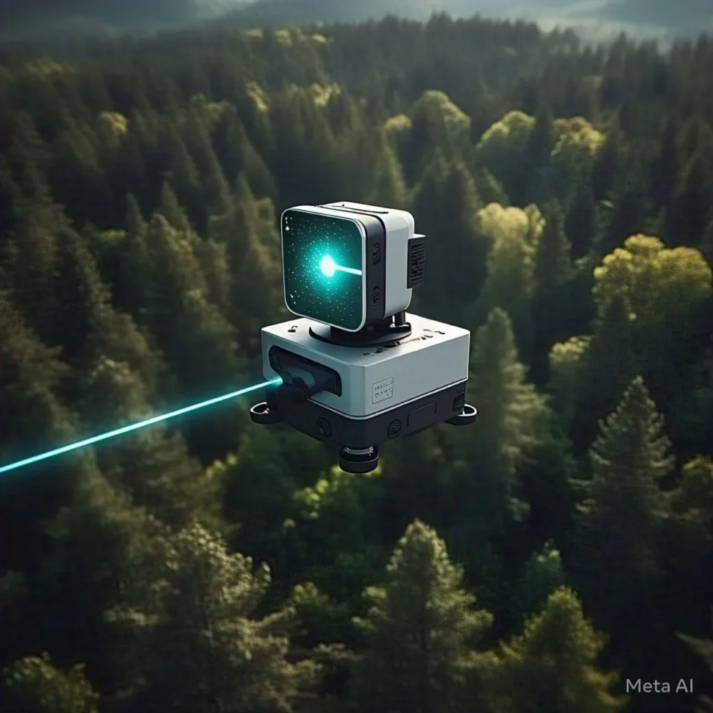
Light Detection and Ranging, also known as LiDAR, is a wonderful technology that is used to create a Three-Dimensional map of the surroundings. In principle, it sends out light rays known as pulses through a laser and calculates the time it takes them to return after bouncing off an object.
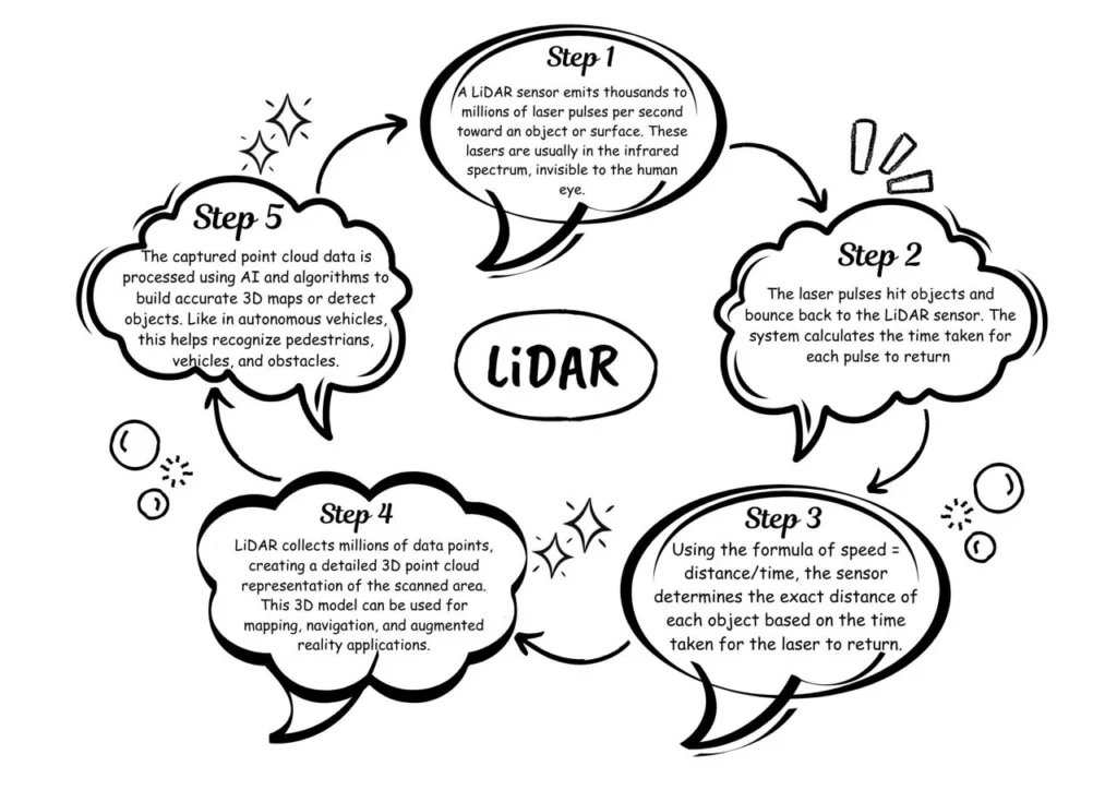
How LiDAR Works?
Applications of LiDAR
- LiDAR in AR/VR: LiDAR helps in the detection of objects and depth mapping of the environment. As it is more precise in scanning surfaces, distances, and many more, this makes the AR experience more immersive and natural.
- Drones and Aerial Mapping: It is used in drones for creating highly detailed topographic maps. It helps in land surveys, agriculture monitoring, and urban planning. DJI drones are one of the examples of LiDAR Drones.
- Space Exploration: This assists in planetary surface mapping as it helps autonomous landers navigate rough terrains. For example, NASA’s Perseverance Rover used LiDAR to explore Mars.
- Smart Cities and Infrastructure: LiDAR can be used for urban planning, traffic monitoring, and designing the infrastructure of buildings. It can be used to build enhanced transportation networks.
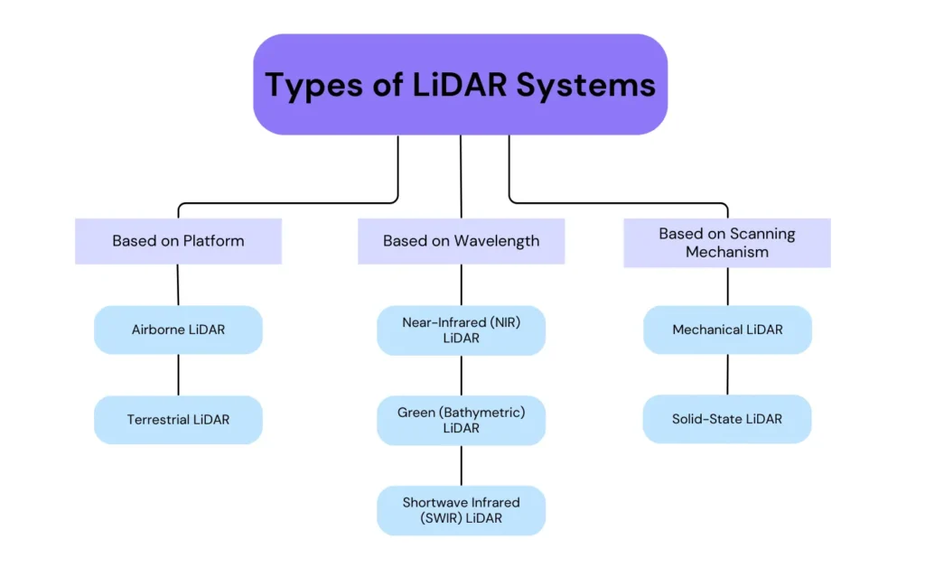
Types of LiDAR Systems
Advantages & Disadvantages
Although LiDAR is a game-changing technology, like any other technology, it has its strengths and weaknesses. In this section, we are going to discuss its Advantages and Disadvantages.
Advantages
- It has very high accuracy and provides very high precision (up to a millimeter level).
- As it uses light rays it provides us with fast data collection and quickly generates 3D maps of large areas.
- It can also work in the dark.
- Unlike ground surveys, LiDAR does not disturb the environment.
Disadvantages
- LiDAR is weather-sensitive and does not work perfectly during rain, heavy fog, and snow due to scattering of light.
- This technology is also very costly, as high-resolution LiDAR sensors are very expensive.
- It has a limited range (short to medium ranges) not ideal for long-distance measurements.
- It requires high computing power and also has high power consumption.
Comparison
| Features | LiDAR (Light Detection and Ranging) | RADAR (Radio Detection and Ranging) | SONAR (Sound Navigation and Ranging) |
| Principle | Uses Pulses to measure distances. | Uses Radio Waves to Detect objects. | Uses Sound Waves to measure objects. |
| Medium | Works best in air and space, struggles in water, and cannot penetrate solid objects. | Works in air, space, and through fog and rain. | Works best underwater but also in the air (e.g., bats, submarines). |
| Range | Short to Medium | Long | Short to Medium |
| Accuracy | High (very precise up to millimeter-level precision) | Moderate(centimeter to meter-level precision) | Depends on water condition |
| Speed | Very fast (speed of light) | Fast (speed of radio waves, which is also light speed) | Slower as compared to the other two. |
Future
- Self-driving cars are the future of the automobile industry. LiDAR technology will enhance the navigation capabilities by providing them with a better understanding of their surroundings with 3-D maps.
- Everyone knows that in the future, robots will become an integral part of our daily lives. LiDAR will help robots avoid obstacles and enhance interaction with the environment, increasing accuracy while performing tasks.
- With time, the technology will improve, and the photography and depth-sensing capabilities of smartphones with LiDAR sensors will improve.
- As LiDAR technology keeps evolving, it will become smaller and cheaper; then it will be adopted in fields like agriculture, health care, and construction, revolutionizing them in the process.
Conclusion
LiDAR is a technology that has served us in many ways. Its creativity in sending light rays and analyzing the time taken to reach back after bouncing, the distance covered by them, and then creating the 3D model of any object irrespective of its size is amazing. We have already seen how it is applied in various fields, especially Spatial Computing, and would be helping in the future as well. These types of new technologies will enhance our tech industry and will provide us with new and immersive experiences.


Pingback: LiDAR Technology and Artificial Intelligence: The Future of Spatial Intelligence | Aiforkids